Citations
Edge partial plans in Bogotá: effects of new Territorial Arrangement Planning on urban expansion areas.
Planes parciales de borde, en Bogotá: efectos del nuevo Plan de Ordenamiento Territorial en áreas de expansión urbana.
Open | Download
Section
Articles
How to Cite
Edge partial plans in Bogotá: effects of new Territorial Arrangement Planning on urban expansion areas. (2021). Revista EIA, 19(37), 37003 pp. 1-22. https://doi.org/10.24050/reia.v19i37.1478
Dimensions


license

This work is licensed under a Creative Commons Attribution-NonCommercial-NoDerivatives 4.0 International License.
Copyright statement
The authors exclusively assign to the Universidad EIA, with the power to assign to third parties, all the exploitation rights that derive from the works that are accepted for publication in the Revista EIA, as well as in any product derived from it and, in in particular, those of reproduction, distribution, public communication (including interactive making available) and transformation (including adaptation, modification and, where appropriate, translation), for all types of exploitation (by way of example and not limitation : in paper, electronic, online, computer or audiovisual format, as well as in any other format, even for promotional or advertising purposes and / or for the production of derivative products), for a worldwide territorial scope and for the entire duration of the rights provided for in the current published text of the Intellectual Property Law. This assignment will be made by the authors without the right to any type of remuneration or compensation.
Consequently, the author may not publish or disseminate the works that are selected for publication in the Revista EIA, neither totally nor partially, nor authorize their publication to third parties, without the prior express authorization, requested and granted in writing, from the Univeridad EIA.
Show authors biography


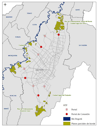
The present study set out to identify the Bogotá Region functional structure from some Partial Border Plans analysis. Likewise, it evaluated the interactions characteristics between Bogotá and the municipalities nearby: patterns of use, social facilities, urban-regional mobility and population density behavior. Cartographic tools obtained from planning instruments were used to identify the interventions in each of the municipalities bordering Bogotá, identifying the level of intervention, the magnitude of the works, and the way in which each of them articulates their planning instruments with development from the city. With partial border plans execution, a regional articulation begins to take shape, which allows a true connection and integration of Bogotá with its neighboring municipalities, but this commitment must be given in equal conditions and opportunities for all municipalities that make up the area called Bogotá Region.
Article visits 967 | PDF visits 666
Downloads
Download data is not yet available.
- Alcaldía Mayor de Bogotá, 2004. Decreto 190. Bogotá: Alcaldía Mayor de Bogotá.
- Alcaldía Mayor de Bogotá, 2010. Plan de Ordenamiento Territorial, Documento Técnico de Soporte, Libro 3. Bogotá D.C.: Alcaldía Mayor de Bogotá.
- Alcaldía Mayor de Bogotá, 2019. Proyecto de Acuerdo, por el cual se adopta la revisión general del POT de Bogotá, Bogotá D.C.: Alcaldía Mayor de Bogotá.
- Consejo Territorial para de Planificación Distrital, 2019. Concepto del Proyecto de Revisión General del Plan de Ordenamiento Territorial de Bogotá D.C., Bogotá: CTPD.
- Contreras, Y., 2016. Sistema Urbanístico en Bogotá: reglas, prácticas y resultados de los planes parciales de desarrollo 2000-2015. Cuadernos de Vivienda y Urbanismo, 9(17), pp. 122-141.
- IGAC, 2019. Geoportal. [En línea]
- Available at: https://geoportal.igac.gov.co/
- [Último acceso: 27 agosto 2020].
- Montes, P. F., 2001. El ordenamiento territorial como opción de políticas urbanas y regionales en América Latina y el Caribe, Santiago: CEPAL.
- República de Colombia, 1997. Ley 388. Bogotá D.C.: Diario Oficial.
- Secretaría Distrital de Planeación, 2017. Resumen del Diagnóstico General del Plan de Ordenamiento Territorial, Revisión ordinaria, Bogotá D.C.: SDP.
- Secretaría Distrital de Planeación, 2018. Plan de Ordenamiento Territorial de Bogotá D.C., Documento Resumen, Bogotá D.C.: SDP.
- Secretaría Distrital de Planeación, 2020. Esudios Macro - Proyecciones de población. [En línea]
- Available at: http://www.sdp.gov.co/gestion-estudios-estrategicos/estudios-macro/proyecciones-de-poblacion
- [Último acceso: 23 julio 2020].
- Secretaría Distrital del Hábitat, 2015. Balance de los instrumentos de gestión de suelo en el marco de la Política de Vivienda y Hábitat humanos, Bogotá: SDH.
- Secretaria Distrital del Hábitat, 2019. Actuación Urbana Integral Ciudad Lagos del Tunjuelo. [En línea]
- Available at: https://www.habitatbogota.gov.co/sites/default/files/documentos/CIOEM%20-%20MESA%20DE%20TRABAJO%202019%20No.%201%20%2814.03.2019%29.pdf
- [Último acceso: 23 agosto 2019].
- Secretaria Distrital del Hábitat, 2019. Proyecto Urbanístico “Ciudad Río”, Bogotá: SDHT.
- Secretaría Distrital del Hábitat, 2020. Indicadores Diagnósticos - Hábitat en las Localidades. [En línea]
- Available at: https://datosabiertos.bogota.gov.co/dataset/9acae4d7-4aa5-43fd-952b-9e05dd746d67
- [Último acceso: 22 julio 2020].
- Velasco, V., Díaz, F. & López, M., 2010. Gestión de suelo en la configuración de bordes de ciudad. El caso del borde occidental de Bogotá. Territorios, Volumen 22, pp. 65-85.