Citations
Comparison of the arithmetic mean, thiessen polygon and DPI methods in the spatial evaluation of pluviometric data.
Comparação dos métodos da Média Aritmética, dos Polígonos de Thiessen e do IPD na avaliação espacial de dados pluviométricos
Open | Download
Section
Articles
How to Cite
Comparison of the arithmetic mean, thiessen polygon and DPI methods in the spatial evaluation of pluviometric data. (2021). Revista EIA, 19(37), 37002 pp. 1-11. https://doi.org/10.24050/reia.v19i37.1500
Dimensions


license

This work is licensed under a Creative Commons Attribution-NonCommercial-NoDerivatives 4.0 International License.
Copyright statement
The authors exclusively assign to the Universidad EIA, with the power to assign to third parties, all the exploitation rights that derive from the works that are accepted for publication in the Revista EIA, as well as in any product derived from it and, in in particular, those of reproduction, distribution, public communication (including interactive making available) and transformation (including adaptation, modification and, where appropriate, translation), for all types of exploitation (by way of example and not limitation : in paper, electronic, online, computer or audiovisual format, as well as in any other format, even for promotional or advertising purposes and / or for the production of derivative products), for a worldwide territorial scope and for the entire duration of the rights provided for in the current published text of the Intellectual Property Law. This assignment will be made by the authors without the right to any type of remuneration or compensation.
Consequently, the author may not publish or disseminate the works that are selected for publication in the Revista EIA, neither totally nor partially, nor authorize their publication to third parties, without the prior express authorization, requested and granted in writing, from the Univeridad EIA.
Show authors biography


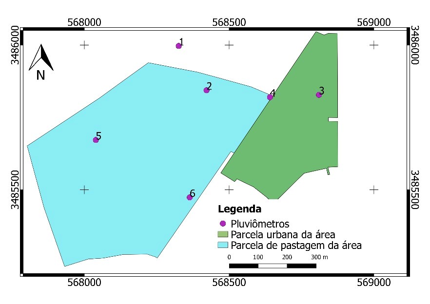
Obtaining a database of rainfall records is of paramount importance for the management of water resources, especially with regard to urban phenomena such as floods. Because of its punctual characteristic, the data are collected at specific points and do not represent entire areas. Therefore, methods to estimate the mean precipitation using these observed data are required. The purpose of this study was to compare three of these methods: Arithmetic Average, Thiessen Polygon and Inverse Distance Weighting (IDW). The data used was from a small area called La Terraza, located in Sierra Vista, Az, USA. The Cross-validation method was used to estimate precipitation values in each method, whereas root mean squared error was the efficiency measure. All methods presented reduced errors, nevertheless the IDW presented more satisfactory results in events with great dispersion of values.
Article visits 569 | PDF visits 414
Downloads
Download data is not yet available.
- Agência Nacional de Águas (ANA). 2013. Resolução nº 903, de 22 de julho de 2013. Cria a Rede Nacional de Monitoramento da Qualidade das Águas Superficiais – RNQA e estabelece suas diretrizes. Disponível em: <http://arquivos.ana.gov.br/resolucoes/2013/903-2013.pdf >. Acesso em: abr. 2018.
- ARAI, F.K. 2010. Caracterização da Disponibilidade Hídrica na Bacia Hidrográfica do Ivinhema, MS. Programa de Pós-Graduação em Agronomia, Universidade Federal da Grande Dourados, Dissertação de Mestrado, 115 p.
- CAMURÇA, P.J. 2011. Cálculo da precipitação média de forma automática pelo método de Thiessen e avaliação da precipitação na bacia do Jaguaribe. Centro de Ciências e Tecnologia da Universidade Estadual do Ceará, Monografia, 76p.
- CARVALHO, D.F. & Silva, L.D.B. 2006. Hidrologia. Disponível em: <https://bit.ly/2ul7WB1>. Acesso em: fev. 2018.
- CASTRO, F.S.; MARTINS, C.A.S.; PEZZOPANE, J.E.M.; CECÍLIO, R.A. & PEZZOPANE, J.R.M. 2010. Avaliação dos diferentes métodos de interpoladores para o parâmetro precipitação pluviométrica no estado do Espírito Santo. Revista Brasileira de Engenharia Agrícola e Ambiental, 14(8): 871–880.
- FRANCO, A.C.L. & UDA, P.K. 2015. Comparação de métodos de espacialização da precipitação na bacia do alto rio Negro, Santa Catarina. In: Simpósio Brasileiro de Sensoriamento Remoto - SBSR, 17, João Pessoa, INPE, Trabalhos completos, p. 3052-3058.
- GIRARDI, R.V.; GOLDENFUM J.A.; SILVEIRA, A.L.L. & DORNELLES, F. 2013. Proposta de um método alternativo para determinação da precipitação média sobre uma área utilizando distâncias invertidas. Revista Brasileira de Recursos Hídricos. 18(1): 19-31.
- HALLAK, R. & PEREIRA FILHO, A. J. 2011. Metodologia para análise de desempenho de simulações de sistemas convectivos na região metropolitana de São Paulo com o modelo ARPS: sensibilidade a variações com os esquemas de advecção e assimilação de dados, São Paulo, SP, Brasil. Revista Brasileira de Meteorologia. 26(4): 591 – 608.
- KENNEDY, J.R.; GOODRICH, D.C. & UNKRICH, C.L. 2013. Using the KINEROS2 modeling framework to evaluate the increase in storm runoff from residential development in a semi-arid environment. Journal of Hydrologic Engineering, 18: 698-706.
- MELATI, M.D. & MARCUZZO, F.F.N. 2015. Espacialização da recomendação de novas estações pluviométricas na sub-bacia 87 segundo os critérios de densidade da Organização Mundial de Meteorologia. In: Simpósio Brasileiro de Sensoriamento Remoto - SBSR, 17, João Pessoa, INPE, Trabalhos completos, p.27-34.
- PROTZEK, C.A.T.G. 2010. Apostila de Hidrologia. Disponível em: <https://bit.ly/2uhJrog>. Acesso em: abr. 2018.
- SALGUEIRO, J.H.P.B. 2005. Avaliação de rede pluviométrica e análise de variabilidade espacial da precipitação: estudo de caso na Bacia do Rio Ipojuca em Pernambuco. Programa de Pós-graduação em Engenharia Civil, Universidade Federal de Pernambuco, Dissertação de Mestrado, 122p.
- SILVA, C.R.; QUINTAS, M.C.L. & CENTENO, J.A.S. 2007. Estudo do método de interpolação do inverso da distância a uma potência. In: II SIMPÓSIO BRASILEIRO DE GEOMÁTICA, 2 / COLÓQUIO BRASILEIRO DE CIÊNCIAS GEODÉSICAS, 5, Presidente Prudente, UNESP, Trabalhos completos, p. 57-62.
- SHINMA, T.A. 2015. Avaliação das Incertezas na Calibração Automática do Modelo SWMM. Escola de Engenharia de São Carlos, Universidade de São Paulo, Tese de Doutorado, 212 p.
- WMO - World Meteorological Organization. 2012. Guide to Meteorological Instruments and Methods of Observation. Disponível em: <https://library.wmo.int/pmb_ged/wmo_8_en-2012.pdf>. Acesso em: mai. 2018.