Citaciones
Comparación de los modelos hecras 1D y 2D para la simulación de ríos urbanos
Comparison of 1D and 2D hecras models for the simulation of urban rivers
Abrir | Descargar
Sección
Artículos
Cómo citar
Comparación de los modelos hecras 1D y 2D para la simulación de ríos urbanos. (2023). Revista EIA, 20(40), 4005 pp. 1-14. https://doi.org/10.24050/reia.v20i40.1661
Dimensions


Licencia

Esta obra está bajo una licencia internacional Creative Commons Atribución-NoComercial-SinDerivadas 4.0.
Declaración del copyright
Los autores ceden en exclusiva a la Universidad EIA, con facultad de cesión a terceros, todos los derechos de explotación que deriven de los trabajos que sean aceptados para su publicación en la Revista EIA, así como en cualquier producto derivados de la misma y, en particular, los de reproducción, distribución, comunicación pública (incluida la puesta a disposición interactiva) y transformación (incluidas la adaptación, la modificación y, en su caso, la traducción), para todas las modalidades de explotación (a título enunciativo y no limitativo: en formato papel, electrónico, on-line, soporte informático o audiovisual, así como en cualquier otro formato, incluso con finalidad promocional o publicitaria y/o para la realización de productos derivados), para un ámbito territorial mundial y para toda la duración legal de los derechos prevista en el vigente texto difundido de la Ley de Propiedad Intelectual. Esta cesión la realizarán los autores sin derecho a ningún tipo de remuneración o indemnización.
La autorización conferida a la Revista EIA estará vigente a partir de la fecha en que se incluye en el volumen y número respectivo en el Sistema Open Journal Systems de la Revista EIA, así como en las diferentes bases e índices de datos en que se encuentra indexada la publicación.
Todos los contenidos de la Revista EIA, están publicados bajo la Licencia Creative Commons Atribución-NoComercial-NoDerivativa 4.0 Internacional
Mostrar biografía de los autores


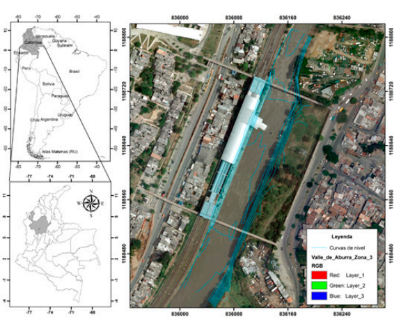
En este trabajo de investigación se realiza un análisis comparativo entre los resultadosde velocidad de flujo y profundidad del agua obtenidos mediante la implementación de dos conocidos software de uso libre, el HEC-RAS 4.1 versión unidimensional y el HECRAS 6.0 versión bidimensional. La simulación hidráulica se realizó en un tramo recto y de geometría trapecial uniforme del canal del río Medellín donde se contaba con topobatimetría y caudales de diseño. Los resultados preliminares obtenidos con el modelo HECRAS 6.0 versión bidimensional sugieren que para tramos rectos y uniformes los resultados de la simulación son bastantes similares a los obtenidos con el HEC-RAS 4.1 versión unidimensional. Se concluye que la elaboración de ambos tipos de modelos exige un grado de experiencia importante, sin embargo, el modelo unidimensional arroja valores de las variables hidráulicas sin un grado de esfuerzo y coste computacional tan alto, sin embargo, es evidente que para efectos de manchas de inundación y definición de profundidades es más conveniente el uso del modelo bidimensional pues permite obtener profundidades mayores.
Visitas del artículo 537 | Visitas PDF 704
Descargas
Los datos de descarga todavía no están disponibles.
- Ardiclioglu, M., Hadi, A. M. W. M., Periku, E., & Kuriqi, A. (2022). Experimental and Numerical Investigation of Bridge Configuration Effect on Hydraulic Regime. International Journal of Civil Engineering, 20(8), 981–991. https://doi.org/10.1007/s40999-022-00715-2
- Bladé, E., Cea, L., Corestein, G., Escolano, E., Puertas, J., Vázquez-Cendón, E., … Coll, A. (2014). Iber: herramienta de simulación numérica del flujo en ríos. Revista Internacional de Métodos Numéricos Para Cálculo y Diseño En Ingeniería, 30(1), 1–10.
- Brunner, G. W. (2010). HEC-RAS, River Analysis System Hydraulic Reference Manual. Version 4.1.
- Brunner, G. W. (2020). HEC-RAS, River Analysis System Hydraulic Reference Manual. Version 6.0 Beta.
- Brunner, G. W., Piper, S., Jensen, M., & Chacon, B. (2015). Combined 1D and 2D Hydraulic Modeling within HEC-RAS. World Environmental and Water Resources Congress 2015. https://doi.org/doi:10.1061/9780784479162.141
- Dasallas, L., Kim, Y., & An, H. (2019). Case Study of HEC-RAS 1D–2D Coupling Simulation: 2002 Baeksan Flood Event in Korea. Water. https://doi.org/10.3390/w11102048
- Deltares. (2022). Delft3D-FLOW, User Manual.
- DHI. (2023). MIKE 21 Flow Model FM.
- Espinoza Vigil, A. J., & Booker, J. (2023). Hydrological Vulnerability Assessment of Riverine Bridges: The Bajo Grau Bridge Case Study. Water. https://doi.org/10.3390/w15050846
- Farias, H. D., Domínguez Ruben, L., & Prieto Villarroya, y J. (2020). Análisis hidro-sedimentológico 2d del comportamiento de un campo de espigones para la protección de márgenes en un río meandriforme. Ribagua, 7(2), 43–55. https://doi.org/10.1080/23863781.2021.1911609
- Ghimire, E., Sharma, S., & Lamichhane, N. (2022). Evaluation of one-dimensional and two-dimensional HEC-RAS models to predict flood travel time and inundation area for flood warning system. ISH Journal of Hydraulic Engineering, 28(1), 110–126. https://doi.org/10.1080/09715010.2020.1824621
- Gibson, S., Sánchez, A., Piper, S., & Brunner, G. (2017, October 31). New One-Dimensional Sediment Features in HEC-RAS 5.0 and 5.1. World Environmental and Water Resources Congress 2017. https://doi.org/doi:10.1061/9780784480625.018
- Hervouet, J. M. (2007). Hydrodynamics of free surface flows, modelling with the finite element method. John Wiley & Sons.
- Huţanu, E., Mihu-Pintilie, A., Urzica, A., Paveluc, L. E., Stoleriu, C. C., & Grozavu, A. (2020). Using 1D HEC-RAS Modeling and LiDAR Data to Improve Flood Hazard Maps Accuracy: A Case Study from Jijia Floodplain (NE Romania). Water. https://doi.org/10.3390/w12061624
- Le, T. B., Crosato, A., Mosselman, E., & Uijttewaal, W. S. J. (2018). On the stability of river bifurcations created by longitudinal training walls. Numerical investigation. Advances in Water Resources, 113, 112–125. https://doi.org/https://doi.org/10.1016/j.advwatres.2018.01.012
- Malik, S., & Pal, S. C. (2021). Potential flood frequency analysis and susceptibility mapping using CMIP5 of MIROC5 and HEC-RAS model: a case study of lower Dwarkeswar River, Eastern India. SN Applied Sciences, 3(1), 31. https://doi.org/10.1007/s42452-020-04104-z
- Mehta, D. J., & Yadav, S. M. (2020). Analysis of scour depth in the case of parallel bridges using HEC-RAS. Water Supply, 20(8), 3419–3432. https://doi.org/10.2166/ws.2020.255
- Mosselman, E. (2020). Studies on River Training. Water. https://doi.org/10.3390/w12113100
- Moya Quiroga, V., Kure, S., Udo, K., & Mano, A. (2016). Application of 2D numerical simulation for the analysis of the February 2014 Bolivian Amazonia flood: Application of the new HEC-RAS version 5. Ribagua, 3(1), 25–33. https://doi.org/10.1016/j.riba.2015.12.001
- Namara, W. G., Damisse, T. A., & Tufa, F. G. (2022). Application of HEC-RAS and HEC-GeoRAS model for Flood Inundation Mapping, the case of Awash Bello Flood Plain, Upper Awash River Basin, Oromiya Regional State, Ethiopia. Modeling Earth Systems and Environment, 8(2), 1449–1460. https://doi.org/10.1007/s40808-021-01166-9
- Rangari, V. A., Umamahesh, N. V, & Bhatt, C. M. (2019). Assessment of inundation risk in urban floods using HEC RAS 2D. Modeling Earth Systems and Environment, 5(4), 1839–1851. https://doi.org/10.1007/s40808-019-00641-8
- Shustikova, I., Domeneghetti, A., Neal, J. C., Bates, P., & Castellarin, A. (2019). Comparing 2D capabilities of HEC-RAS and LISFLOOD-FP on complex topography. Hydrological Sciences Journal, 64(14), 1769–1782. https://doi.org/10.1080/02626667.2019.1671982
- Tamiru, H., & Dinka, M. O. (2021). Application of ANN and HEC-RAS model for flood inundation mapping in lower Baro Akobo River Basin, Ethiopia. Journal of Hydrology: Regional Studies, 36, 100855. https://doi.org/https://doi.org/10.1016/j.ejrh.2021.100855
- Universidad Nacional. (2013). Estudio de patología del canal del río Medellín entre la variante de Caldas y la desembocadura de la quebrada La García: Informe final revisado / (#000806553). Medellín.
- Villaret, C., Hervouet, J.-M., Kopmann, R., Merkel, U., & Davies, A. G. (2013). Morphodynamic modeling using the Telemac finite-element system. Computers & Geosciences, 53, 105–113. https://doi.org/https://doi.org/10.1016/j.cageo.2011.10.004